Esan Geography And Topography – South of Nigeria

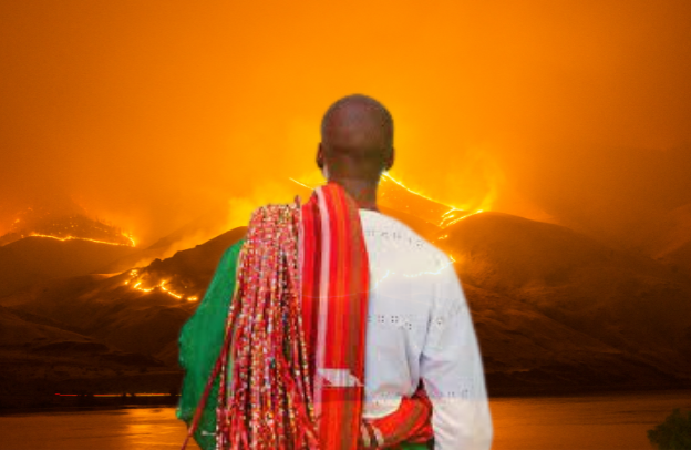
Often, people refer to the Esans and the Binis as one because they are in the same state. Though the Binis and Esans are related, have the same historical background, and are affixed in the same ethnic group, called the Edo group of people, some slight shades of difference still exist between them.
Learn How to Leverage Your Story through our Story To Asset Framework.
The Esan people or Ishans inhabit the Esanland. Though there isn’t an accurate population number, the estimate of the Esan people is about 1.50 million, and they comprise 35 kingdoms or clans:
- Irrua,
- Ekpoma,
- Uromi,
- Ubiaja,
- Egoro,
- Ekpon,
- Ewohimi,
- Emu,
- Ewatto,
- Ewossa,
- Amalu,
- Igueben,
- Idoa,
- Illushi,
- Ifeku,
- Iyenlen,
- Iruekpen,
- Ohordua,
- Okhuesan,
- Oria,
- Onogholo,
- Orowa,
- Opoji,
- Ogwa,
- Okalo,
- Ebelle,
- Ewu,
- Ugboha,
- Uroh,
- Ugbegun,
- Ukhun.
Uzea, Udo, Urohi, Ojiogba, Ugun and are ruled by a king called Onojie. Esanland culture, language, beliefs, and all were totally influenced by the mass exodus to Esan territory. The Esans success and unity were already ingrained from the pre-colonial times, and their cooperation and unity helped them to work hand in hand during the advent of the colonial masters.
See also our previous article: Esan Unity: The Bedrock For Sustainable Development
This article spotlights Esanland’s geography and topography.
Geography of Esan land
The boundary definition was established during the European man’s incursion into Africa. Prior to their foray into the interiors of Africa, people never defined a particular territory graphically.
Mostly, environmental features, including hills, land, rivers, and streams, help to mark an exit from a kingdom or infusion into another kingdom. The Esanland is bordered to the North West by Owan, to the North East by Etsako, and on the South West by Orhionwon and Ika. Then to the South and South East with Aniocha and Oshimili areas.
The Esan settlers are believed to be Savannah dwellers, and upon their migration to Esanland, they exhibited their way of living in the Savanna areas-that is, inhabiting Esanland interfluves, ditching the valley.
This preference of inhabiting the upper interfluve boils down to their beliefs that settling in the valley wouldn’t be favorable to their crops, considering how flooded it gets during wet seasons, and a few other glitches that won’t benefit them and their crops. Thus, making the valley “a no man’s land.”
In the course of reliving their Savannah mode of inhabitation, they constructed ponds to avoid constant visitation to the river, streams, or the valley. According to a recent study, Esanland has about 1,858 square kilometers, and the topsoil is exceptionally great, allowing more cultivation of crops.
The growth of yams staples in Esanland stands to prove how nutritionally rich the soil is. The topsoil is precisely a confound of sandy light brown soil and laterite, which, according to Professor Akinbode, contains fine-grain sand, clay, carbonaceous shaley clays, and lignite.
Land Division In Esanland
Though the majority of the Esans reside on the plateau, a few others inhabit the lowland areas. Chiefdoms like Irrua, Ekpoma, Ubiaja, Ugboha, and Uromi reside on the plateau, whereas chiefdoms like Ewu, Orhodua, and Ewohimi reside on the lowlands.
Basically, the lowlands are flanked by several streams, rivers, etc., supplying intense water to the population. Well, the surplus water supplies obtained in the lowland areas are in complete shortage in the interfluve areas, thereby bereaving the residents of an adequate water supply.
Majorly, those that reside in the plateau areas don’t have a natural source of water supply; hence, all villages possess central ponds where people can fetch water. However, these central ponds are said to be dug through communal efforts under the directives of the village elders and Onojie.
Though in most cases, some families can dig and maintain their own pond( Omin), whereas the village unit generally maintains that of the central village pond(Oghodo). The Esans sate their needs for water through this measure until pipe-borne water was introduced during the 1950s.
Another source the Esans sate their water needs is through Odighi or seasonal lakes that usually form during the wet season. The Esans resort to drawing water from the Odighi during the wet season, compared to the dry season, as the water dries up, following the digging of water holes in the area.
Esanland and Mineral Resources
The rich minerals derivable from the soils of Esanland can’t be overlooked. As said, the soil is nutritious and also decked with gems like gold. In Esanland, kaolinitic clay (eko) is usually derived from the plateau. However, the people validate the eating of the clay by women during gestation periods.
Lores have it that the Kaolinitic clay helps to subside early morning sicknesses during pregnancy and helps to keep the fetus fit and strong.
Not only is the Kaolinitic clay(eko) useful during pregnancy, but it’s also used in the production of medicines, hence the covet for the clay by the residents.
As the eko is highly valued and found in all of the Esanland plateau, another form of clay is usually derived in the lowland areas, and it equally serves various purposes.
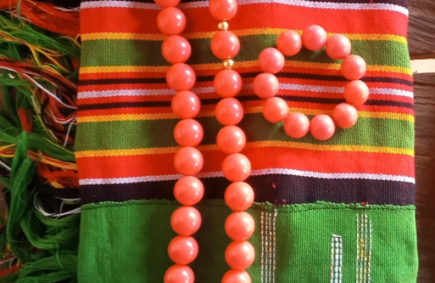
This pure white clay, called (Erhe) by the Esans, is used for adornment of bodies, burial, performing sacrifices, and decorating homes during ceremonies and festivals. Furthermore, the Erhe is usually procured in powdery form until it’s processed and molded into different forms and sizes.
There’s also another form of clay available in Esanland. This form of clay, called (Unakpa) is red in nature and is mainly used to construct houses that last for generations. Red clay is believed to possess some spiritual qualities.
The Esans believe red color is not ordinary and helps to shoo evil spirits. Therefore, using the clear in constructing houses equally helps to protect the inhabitants from any jinx of the evil spirits. Additionally, the Esans herald that the blend of red color and white ushers in peace and prosperity in every home. More reasons the residents sought after the clay.
As mentioned above, gems are also derived from Esanland soil. More predominant gems are gold, mainly gotten in Ekpoma and Uzea. This precious metal is contained and preserved from exploitation through the implementation of religious sanctions.
Mining of gold back in pre-colonial times was performed at nightfall to keep the site discreet. The earth shrine priest (Oto) consents to mine gold, meaning that mining gold without Oto’s permission will incur punishments stipulated according to the law.
You might consider reading – Esan Local Government Areas in Edo State, Nigeria
The Climate of Esanland
Esanland’s climate is usually in correspondence with other parts of the country in the present day. The Wet Season, the dry season, and the harmattan (Okuakhua). The wet Season occurs from April to October every year. That period usually marks the beginning of agricultural activities by the farmers.
The dry Season comes around November to March, through the harmattan period comes in between from December to January.
In conclusion
Esanland has a very large topography and the most diverse climatic conditions. The climate varies from hot in the south to cooler in the north. It is not very different from many other places in Nigeria, but there are differences in elevation, rainfall, and temperature as well as their vegetation.
Written by Juliet Emmanuel for African Docs Project.
Learn How to Leverage Your Story through our Story To Asset Framework.